
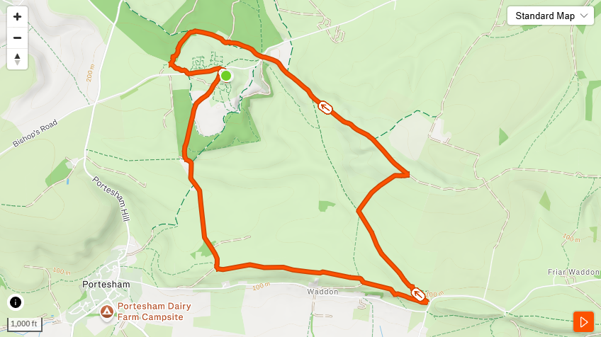
The Hardy Monument loop has been on the TOL list since before we had a list. Six miles, 863 feet of elevation, a 72-foot Portland stone column sitting at 771 feet above sea level, and views that run from Abbotsbury to Portland Bill in one sweep. It earns its reputation without needing to embellish it.
This is TOL Route F. The walk starts and finishes at the National Trust car park on the Black Down ridge — signed off the B3159 between Martinstown and Abbotsbury — and takes in open heathland, chalk tracks, field paths, and dry stone walls before climbing back to the monument from the south and east. The South Dorset Ridgeway runs through the upper section. Three waymarking systems operate throughout: the Hardy Monument Trail’s blue circular compass rose markers at the key junctions, South Dorset Ridgeway posts on the ridge sections, and yellow Dorset County footpath arrows on the lower field paths. Signage is consistent. A map is still recommended on open heathland.
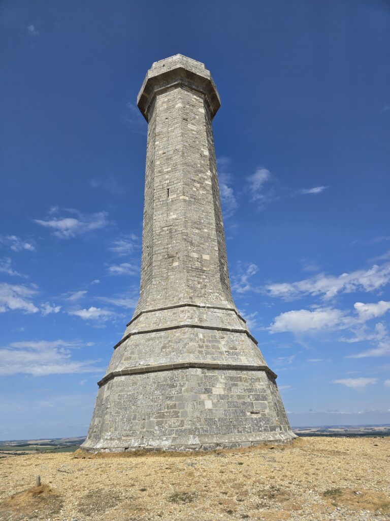
The Hardy Monument. Portland stone, 72 feet, 771 feet above sea level.
The monument
If you’ve driven the B3159 and spotted what looks like a lighthouse on the skyline, this is it. The Hardy Monument was built in 1844 by public subscription, five years after the death of Vice Admiral Sir Thomas Masterman Hardy. This is not Thomas Hardy the novelist — that Thomas Hardy was born in 1840, twenty-one years after this one died. Both men are embedded in Dorset’s story. Only one has a column.
Hardy was Nelson’s flag captain at Trafalgar. He was born in Kingston Russell, a few miles from where the car park sits. He was beside Nelson when he died on 21 October 1805, and his name is attached to one of British history’s more debated last words. The column is octagonal, Portland stone, 72 feet tall. On a clear day the coast is visible in every direction.
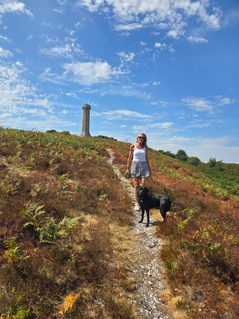
The final approach. Open heathland, gorse, and the column just above.
The route
From the car park the route drops south and east immediately, via metal farm gates and field paths across open farmland. The monument disappears behind you almost straight away — and then reappears as a small spike on the skyline ahead, which turns out to be a useful orientation marker throughout the lower loop. You always know where you are in relation to where you’re going.
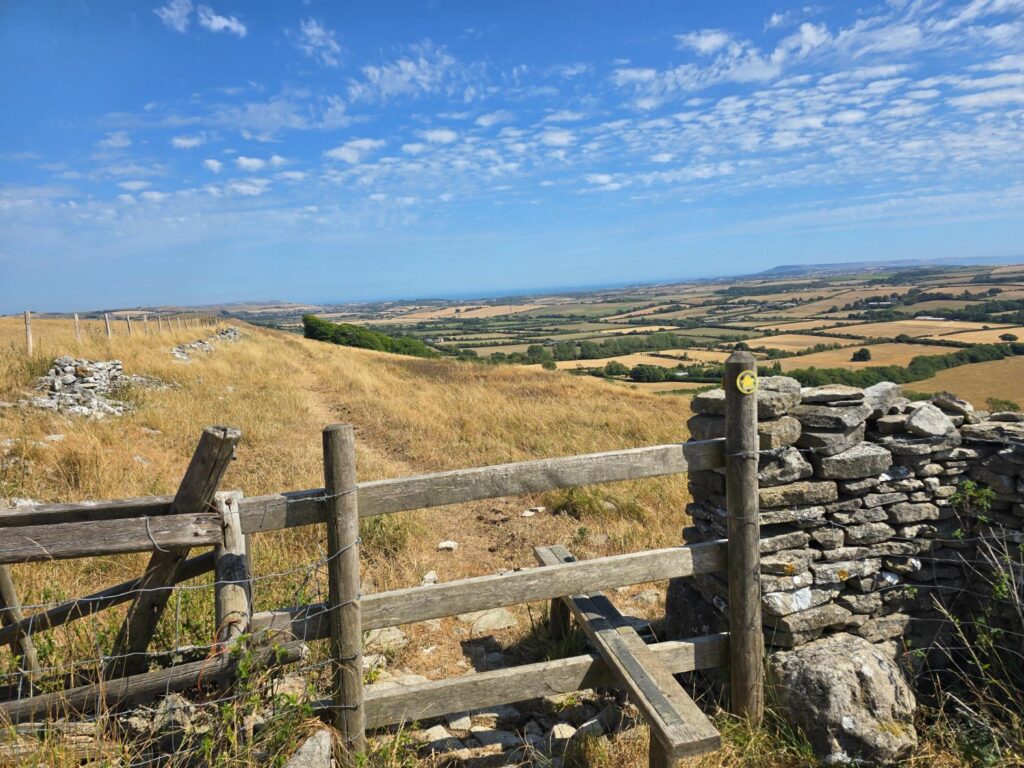
Chalk track south of the ridge. Onto the Dorset CC path, about half way round. Portland imperious in the distance.
The lowest part of the route.
The lower section follows chalk and gravel tracks with dry stone walls on either side, crossing open farmland before the loop around Waddon. The terrain is good underfoot: well-surfaced chalk, a few grassy field paths, gates throughout. A South Dorset Ridgeway signpost at the field junction marks destinations including Hardy Monument, Bincombe, and Hell Bottom (half a mile; we didn’t investigate).
The loop climbs back northwest to the ridge via the South Dorset Ridgeway, which delivers you onto open heathland — gorse, bracken, and big views — for the final approach. The character of the walk changes completely here. From enclosed field paths to exposed ridge in the space of a few hundred metres. This is the AONB at full volume.
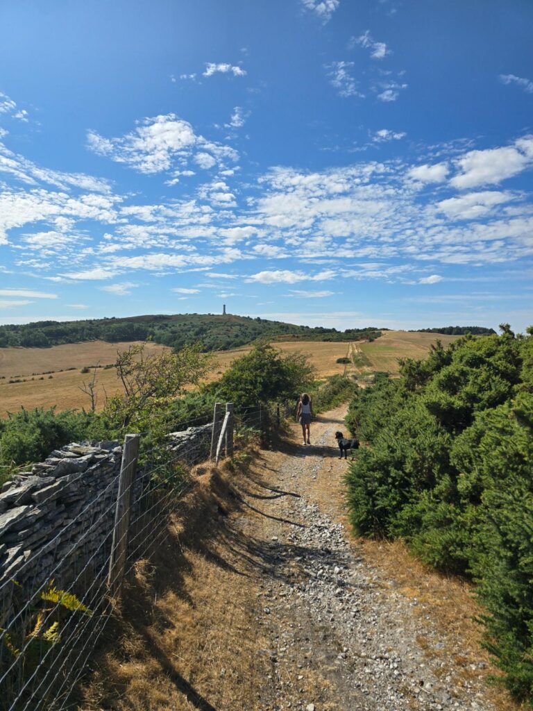
A long flowing stretch of path as we push back towards the start. This can get a little blustery on some days, but worth it for that view.
The Stone Installation. National Trust.
Just below the monument, there’s a stone installation worth knowing about: several dry stone structures arranged around a standing stone, each with a rectangular window opening. Made from the same material as the field walls. It reads as a viewfinder or seating installation, and it’s a good place to stop before the final climb to the column.
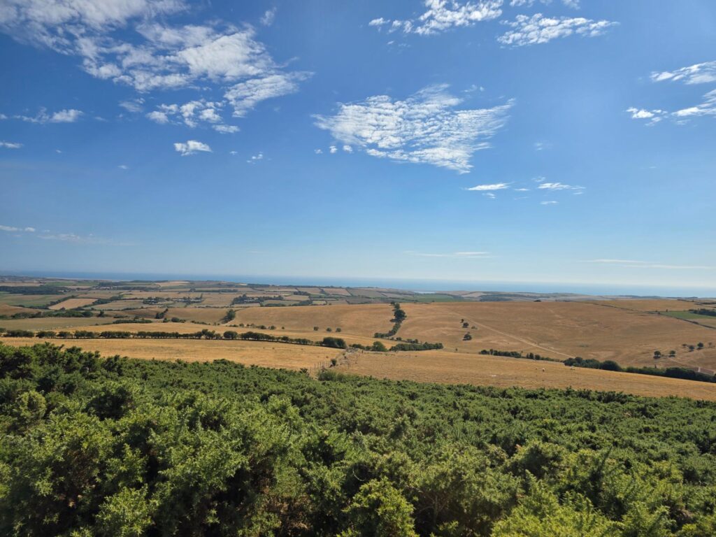
At the summit the view opens fully: Fleet lagoon to the west, Portland Bill on the horizon, fields running south toward Abbotsbury. 863 feet is the number. The view earns it.
An honest note on the gorse
There are sections on the upper approach where the path narrows and gorse closes in on both sides. In July, in shorts, this is uncomfortable rather than impassable — but a group with mixed kit would find certain pinch points genuinely frustrating, and the correct line isn’t always obvious.
We’re walking a slightly adjusted line on the upper section before confirming this as a full group route. Route F will be updated once that revised line is confirmed. The bones of the route are excellent. The gorse is the one fixable problem.
Amendment: We found two ways round, but have left the climb up to the gorse area, we just slip around the side rather than through. A really good route now. This can also be modified to remove the climb if the group requires it on the day.
Practical
- Start/finish: National Trust car park, Black Down (signed off B3159 between Martinstown and Abbotsbury)
- Distance: 5.96 miles
- Elevation: 863 ft
- Moving time: 2:11:22
- Steps: 13,192
- Terrain: Heathland, chalk track, field paths, dry stone walls
- Grading: Moderate — sustained elevation on the climb back to the ridge
- Dog-friendly: Yes. Gates throughout. Dogs on leads on farmland sections.
- Café: None on route. Martinstown is the nearest village.
Below is a downloadable PDF copy of this route that you can follow on your own at any time.
If you would like to join us on a planned Thinking Out Loud Runners walk / run at any point, please get in touch using the contact form below.